GREET ME
at the
AIRPORT

Click Here
When I finally arrive
in your city, I hope you'll be waiting for me on the tarmac.
You only have to say where you live.
Send me an E-mail
or sign the
Guestbook
|
Do
you
Believe
I'm
crazy?
That
I Never
Gonna
Do It?
Give your
opinion by E-mail
or in the
Guestbook
|
|
|
NEWS ARCHIVE Page
3
NOTE:
Unlike the Main Page, where latest news appear at the top, here you will
find the news sorted chronologically, from top to bottom
 Back
to the USA: Back
to the USA:
Georgia Tour
(Jan. 14th VD/June 13th
RD) SAVANNAH,
Georgia, USA:
The return flight from Bermuda took only 3 hours and 33 minutes,
despite the distance being more than 120 nm longer than yesterday's (838
nm). I took off before dawn and strong tailwinds escorted me most of
the time, achieving a speed average of 236.06 kt, including climb,
descent and approach. I arrived in Savannah (KSAV, #465) at
mid-morning, with less than 1 mile of visibility. Then, after more than an
hour waiting for the weather to improve, the tour of the 317 airports
in Georgia began. |
 Celebration
in Augusta Celebration
in Augusta
(Jan. 15th VD/June 19th RD) AUGUSTA,
Georgia, USA: When
you watch
on TV the
Masters of Golf, live from Augusta, you can clearly hear the noise of planes
taking off. Now I can see why: the golf course and Daniel airport
(KDNL) are
very, very close. Miss
the runway and you can land on the fairway of the 18th hole. Many golf
champs celebrated in Augusta, and today I celebrate in Daniel my 500th airport in
the tour around the world. ENLARGE |
Airport Density
(Jan. 16th VD/June 28th RD) ATLANTA,
Georgia, USA: The
 Greater
Atlanta is one of the urban areas with the biggest airport density in
the world. About 100 airports and airstrips surround the city,
mainly in the East and Southeast. Some airfields are separated by less
than 1 mile and often, as in Whitesburg, west of Atlanta (photo),
you can find three or four in a very small area. On this stage, the speed
average will drop dramatically and the fuel consumption will rise. ENLARGE Greater
Atlanta is one of the urban areas with the biggest airport density in
the world. About 100 airports and airstrips surround the city,
mainly in the East and Southeast. Some airfields are separated by less
than 1 mile and often, as in Whitesburg, west of Atlanta (photo),
you can find three or four in a very small area. On this stage, the speed
average will drop dramatically and the fuel consumption will rise. ENLARGE |
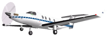
Planes for S.
Carolina & Bermuda
(June 18th RD)
Georgia, USA: The
aircraft section has been neglected
for a long time. I'm still delayed, but I have just redesigned the section
with the latest version of the Pilatus PC-12. A few days ago I added five aircraft for
South Carolina and now three for Bermuda
Islands. For North Carolina, I added the newest version of the Wright
Flyer. In the next few days I will add some planes for Georgia. |
Shortest &
Shortest
(Jan. 16th VD/June 28th, July
7th RD) DOUGLASVILLE
and ACWORTH,
Georgia, USA: Back
in April, when I was visiting  North
Carolina, I landed in Royals, so far the shortest runway I had
encountered (700 feet), and I said: "I guess I will not
find a shorter one in the rest of the flight". I was wrong. Today
I landed in Georgia Lite Flite (31GA, # 579), where the
"runway" is in fact a square (600 x 600 feet), in the
style of the old airfields of the early days of the aviation era, when
runways didn't exist and the pilot looked at the windsock and pointed
his/her plane in whatever direction the wind was blowing. I would lie if I
said it was a good landing. I ran out of runway, in spite of a little
cheating: I used the diagonal to gain a few feet (848). Thanks to
Pythagoras! ENLARGE
PHOTO North
Carolina, I landed in Royals, so far the shortest runway I had
encountered (700 feet), and I said: "I guess I will not
find a shorter one in the rest of the flight". I was wrong. Today
I landed in Georgia Lite Flite (31GA, # 579), where the
"runway" is in fact a square (600 x 600 feet), in the
style of the old airfields of the early days of the aviation era, when
runways didn't exist and the pilot looked at the windsock and pointed
his/her plane in whatever direction the wind was blowing. I would lie if I
said it was a good landing. I ran out of runway, in spite of a little
cheating: I used the diagonal to gain a few feet (848). Thanks to
Pythagoras! ENLARGE
PHOTO
Earlier today I made the shortest flight of this
expedition. The hop between Chattahoochee Air Park (4GA6, # 565)
and Miller Farm (25GA, # 566) lasted only 1:07 minute from
throttle up to a full stop (about 40 seconds airborne). The distance
between airports, measured
from the middle of the runways, is
1.0 nm.
Finally, There is another record for today: 60
airports visited in one day. |
New Record of
Landings
(Jan. 17th VD/July 13th RD) GREATER
ATLANTA, Georgia, USA: Thanks
to the proximity of airports surrounding Atlanta, today I visited a record
65 airfields, breaking yesterday's mark of 60 in a single day. |
Overcast with no
Clouds
...and some FS Art
(Jan. 17th VD/July 13th RD) GREATER
ATLANTA, Georgia, USA: It
was good news when Jeppesen-Sanderson Inc. gave
Microsoft its huge aviation database for use in FS2k. But the
software octopus, as usual, messed things up. The problem is with some
airports which are very close to others (less than one mile) but have different
elevations. |


 |
In some cases, the runway elevation is below the terrain
elevation and on the approach you can see buildings, taxiways, etc.,
but not the runway, which appears only at the last moment, when you descend below the
terrain, as if you were breaking out of the overcast. Once you land
, everything becomes confusing, objects float in the air (top photo), and you
see some strange shapes. The aircraft can even crash if you taxi off the
runway. Microsoft had better put these close airports at the same
altitude, sacrificing some accuracy of the data in the name of its
technical limitations. No one would have cared of finding an FS airport
(usually a small airfield) a few feet below its real world elevation, but
it's really annoying to find these bugs, realizing you paid for a product
which was not thoroughly tested and shouldn't have been released.
But let's try to extract something positive out of
this. If I don't go down in history for this flight around the world, I
would like to be remembered as the founder of a new school of modern art
called, obviously, FS Art. To make one of these masterpieces, just
fly your plane to one of these airfields (Don't use the 'Go To Airport'
menu; it won't work). Switch to 'Spot Plane' view (shift+S) and 'Slew'
mode (Y). Now turn your plane around (shift+4/6) and capture the image
with your favorite graphics program. |
BACK TO MAIN PAGE
NEWS
ARCHIVE Page 2
NEWS
ARCHIVE Page 4
NEWS FROM THE BEGINNING
|